

Call us at : 702.633.4413
Our 3D laser scanner automatically and rapidly captures millions of points, constructing a 3D image of the building or structure. At each set up position the scanner fires a laser at the building’s surface and the return signal measures a grid of points over the surface (in some cases only 1mm apart) called a point cloud. Individual point clouds are then combined to create a 3D model.
A 3D Laser Scanner can be positioned up to 120 meters from the target area and can collect 3 million measurements every minute in a full 360 degree dome. This range enables the surveyor to be less intrusive, work more safely and survey areas previously considered inaccessible when using conventional total station.
The Laser Scanner can also take color photographs of the scan area and map the color or texture information onto the survey point data.
Altogether this enables everyone working on the project to gain a better understanding of the site and the data collected, whether they are on site or office based and from viewpoints and perspectives that would never be physically possible.
The point cloud can opened in a number of software packages, including the most recent AutoCAD release and allowing both 2D and 3D CAD drawings to be created.
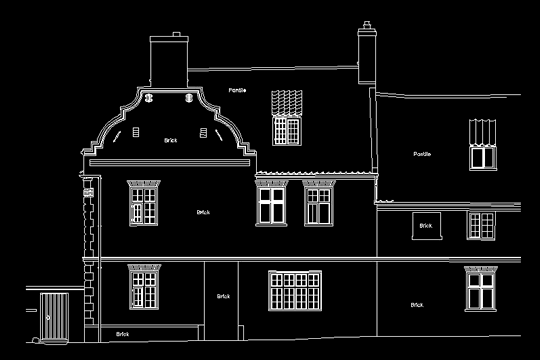
As-Built Surveying From Point Cloud to CAD Drawing
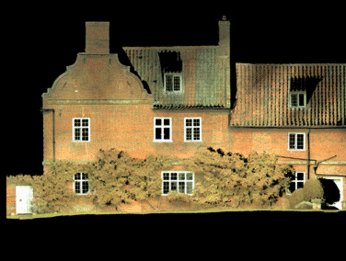
Point Cloud
CAD Drawing
For more information please: